
Who Owns the Response?
A clip going around says the public cannot see threats to grids, satellites and drones. Some of that evidence is public. This brief reads three public sources as a program question for airports: when a drone or a jamming event hits, who owns the decision?
As of October 16, 2026. Every figure below was checked against its source, and anything we could not verify is labeled.
Read the text version of the graphic
Sticky notes.
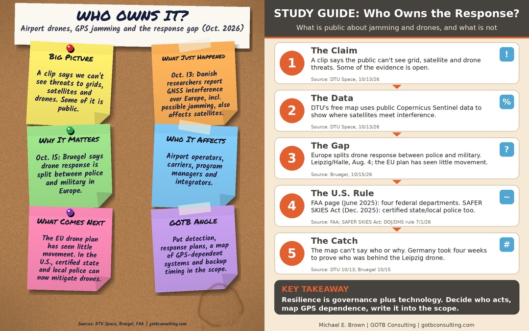
- Big Picture: A clip says we can't see threats to grids, satellites and drones. Some of it is public.
- What Just Happened: Oct. 13: Danish researchers report GNSS interference over Europe, incl. possible jamming, also affects satellites.
- Why It Matters: Oct. 15: Bruegel says drone response is split between police and military in Europe.
- Who It Affects: Airport operators, carriers, program managers and integrators.
- What Comes Next: The EU drone plan has seen little movement. In the U.S., certified state and local police can now mitigate drones.
- GOTB Angle: Put detection, response plans, a map of GPS-dependent systems and backup timing in the scope.
Study guide.
- The Claim: A clip says the public can't see grid, satellite and drone threats. Some of the evidence is open. (DTU Space, 10/13/26)
- The Data: DTU's free map uses public Copernicus Sentinel data to show where satellites meet interference. (DTU Space, 10/13/26)
- The Gap: Europe splits drone response between police and military. Leipzig/Halle, Aug. 4; the EU plan has seen little movement. (Bruegel, 10/15/26)
- The U.S. Rule: FAA page (June 2025): four federal departments. SAFER SKIES Act (Dec. 2025): certified state/local police too. (FAA; SAFER SKIES Act; DOJ/DHS rule 7/1/26)
- The Catch: The map can't say who or why. Germany took four weeks to prove who was behind the Leipzig drone. (DTU 10/13; Bruegel 10/15)
Key takeaway. Resilience is governance plus technology. Decide who acts, map GPS dependence, write it into the scope.
The numbers
Every number here is reported by the source named under it. The think-tank figures are analysis, not audited data. Details and limits are below.
What the three sources say
The jamming reaches orbit
DTU Space reports that GPS and satellite-navigation (GNSS) jamming, which has disrupted flights and shipping across Europe, also reaches satellites in low Earth orbit. Researchers built a free map from public Copernicus Sentinel data. Interference is extensive over Europe, particularly eastern Europe.
The map cannot say who is jamming or whether it is deliberate.
Source: DTU Space, Oct. 13, 2026A job that belongs to no one
A Bruegel analysis says responsibility for responding to drones is split between police and military and between levels of government. It describes the Aug. 4 Leipzig/Halle incident, which Germany formally blamed on Russia on Sept. 1, with proof taking four weeks. Bruegel also says drone incidents near critical infrastructure have quadrupled in a year (it gives no underlying data) and that the EU’s February action plan has seen little movement.
Source: Bruegel, Oct. 15, 2026Different rules, and they changed
The FAA’s airport page (last updated June 23, 2025) says the FAA does not support counter-drone systems used by anyone other than the federal departments with explicit statutory authority (Defense, Homeland Security, Justice and Energy). Detection tools “do not have the ability to determine intent or the level of threat,” and airports certified under Part 139 need an approved UAS response plan.
Since then, the SAFER SKIES Act (signed Dec. 18, 2025) lets certified state and local law-enforcement and correctional agencies detect and mitigate credible drone threats. A DOJ/DHS interim final rule took effect July 1, 2026.
Source: FAA airport page; Federal Register, July 6, 2026Reading it fairly
The clip lumps threats together
The viral claim treats jamming, drones and grid attacks as one story. They are not. The DTU map shows where interference appears, not who causes it. Bruegel’s piece is a think-tank analysis that reflects its authors’ views, and its “quadrupled” figure has no published data behind it.
Source: DTU Space; BruegelCounter-drone tools can disturb GPS
The FAA’s GNSS resource guide notes that the Defense Department and certain law-enforcement agencies can use counter-drone systems that jam or spoof GNSS signals to force unauthorized drones to land. That is one reason mitigation is tightly controlled, and why GPS dependence matters to an airport’s own systems.
Source: FAA GNSS resource guideNot the airport operator
The Act and the rule name law-enforcement and correctional agencies as the authorized parties, under federal coordination, certification and reporting conditions. An airport or its contractors would plan, detect and coordinate, but would not be the party that mitigates. The FAA also asks airports to coordinate with it before installing detection or mitigation systems.
Source: Federal Register; FAAWhat this means for airport programs
- Write the handoffs. Put detection, the UAS response plan and the call tree in the scope, naming the operator, local police and federal contacts.
- Map GPS dependence. List which airport systems rely on GPS time or position, from timing sources to vehicle tracking. A system you have not listed is a system you cannot protect.
- Test the fallback. Ask for tested holdover or backup timing and navigation sources, and rehearse them.
- Coordinate before you buy. The FAA asks airports to coordinate before installing detection or mitigation systems. Make that a gate in the procurement schedule.
- Keep it fair. Certified small and local firms that can plan, test and operate these systems are worth watching, and clear scopes let them compete.
Timeline
- Aug. 4, 2026Quadcopter with plastic explosives strikes an aircraft at Leipzig/Halle; it fails to detonate (Bruegel).
- Sept. 1, 2026Germany formally blames Russia, four weeks after the incident (Bruegel).
- July 1, 2026Federal rule implementing the SAFER SKIES Act takes effect for state and local law enforcement (Federal Register).
- Oct. 13, 2026DTU Space reports GNSS interference over Europe also affecting satellites in orbit.
- Oct. 15, 2026Bruegel publishes its analysis of the European governance gap.
What we could not verify
- Who is jamming, and why. DTU says its map cannot determine the source or whether the interference is deliberate. We make no claim either way.
- The “quadrupled” figure. Bruegel gives no underlying data for it. We report it as the think tank’s statement.
- Attribution of the Leipzig/Halle incident. We report that Germany formally blamed Russia, as Bruegel states. We did not independently verify the investigation.
- Your airport’s status. The FAA page cited was last updated in June 2025, before the new law and rule. We did not check for later FAA guidance, so confirm current requirements with the FAA.
- The viral clip. We did not verify any social video, and no social caption is used as a source on this page.
Sources, checked on October 16, 2026
- DTU Space, “GPS jamming over Europe is also disrupting satellites in space” (Oct. 13, 2026)
- Bruegel, “Everybody’s job is nobody’s job: a governance gap means Europe is insufficiently protected from drones” (Oct. 15, 2026)
- FAA, “UAS Detection, Mitigation, and Response on Airports” (page last updated June 23, 2025)
- Federal Register, “Counter-UAS Authority for State, Local, Tribal, and Territorial Law Enforcement and Correctional Agencies” (July 6, 2026)
- FAA, GPS and GNSS Interference Resource Guide
What is ours. The plain-words boxes and the points on contracts and procurement are GOTB’s interpretation, labeled as such. Everything else is quoted or counted from the sources above.
Claims and findings. This brief summarizes public sources. It does not assess any specific airport, vendor or incident, and it takes no position on who is responsible for any event.
This page is general information, not legal, engineering, security or investment advice, and it does not promote any product or company. Figures are as reported by the sources linked, as of October 16, 2026.

About
Meet Michael E. Brown
President and Managing Partner, GOTB Consulting, LLC · Chicago
Michael E. Brown has 20+ years of governmental and municipal consulting and lobbying experience. He was lead contract negotiator on the $8.5B O’Hare 21 program and the $800M O’Hare rail extension, and lead lobbyist and contract negotiator on the $400M Chicago Department of Water Management lateral redevelopment. (Dollar figures are program sizes, not GOTB fees.)
He has worked with the Illinois legislature and public officials on public-private partnership (P3) policy, and has consulted to the Cook County Commission on reducing duplicative administrative offices. He is a frequent speaker at governmental and municipal functions, focuses on good government and healthier social and economic solutions for safe, successful neighborhoods, lives in Chicago, and serves on the Board of the March of Dimes.
- M.S., Psychology (1997), University of Iowa
- B.S., Psychology (1995), University of Iowa
About
Meet Richard Butler
Partner, GOTB Consulting, LLC · Chicago
Richard (Rich) Butler is a partner at GOTB Consulting and a 38-year veteran of Chicago city government. From August 2019 to February 2020 he served as First Deputy Commissioner and Chief Administrative Officer of the Chicago Department of Aviation (CDA), responsible for day-to-day administration and operations of O’Hare and Midway, including finance, contracts, operations, legal, human resources, workforce development, concessions, real estate and vehicle services. CDA manages the two airports with a federally funded budget of $8.5 billion. (Dollar figures are budget and program sizes, not GOTB fees.)
Before that, Rich was First Deputy Procurement Officer at the City’s Department of Procurement Services and Chief Administrative Officer of the Chicago Park District, where he oversaw procurement, audit, finance, warehousing and general administrative services on an estimated annual budget of $385 million and established district-wide policies and procedures. His City career began at the Department of Aviation as Director of Contracts Administration, and he also served as General Superintendent of the Department of Streets and Sanitation.
He completed the Chicago Accounting and Purchasing System Training Program and the City of Chicago Executive Management Program, was a key team member on the design and implementation plan for the City’s new eProcurement system, and is a member of the National Institute of Governmental Purchasing and the Purchasing Management Association of Chicago. He has served on the board of the Chicago Municipal Employees Credit Union and on the US Communities board, representing the City of Chicago, and traveled to South Korea to represent Chicago in the Kotra Alliance to bridge contracting opportunities. A native of Englewood, he attended De La Salle High School.
- B.S., Northern Illinois University









Fictional characters from GOTB’s original stories. Real-world facts always link to public sources.